Landsat
03/01/13 05:31
The Landsat 5 mission is officially over. The recent failure of a gyroscope left the USGS and NASA no option except to declare that the mission is now over. But what a ride it has been. Landsat 5 was launched in 1984. It was expected to carry out a three-year mission of photographing our planet. But kept working and it kept taking pictures and it went on and on and on. But space is a harsh environment for a mechanical device and there have been problems. Each time in the past engineers have found a way to work around the problems. This time they could find no solution.
Now it its 29th year of orbiting our planet, it has made 150,000 circuits around our world and transmitted over 2.5 million images of the surface of the earth. It has given us a nearly three-decade view of how our world is changing.
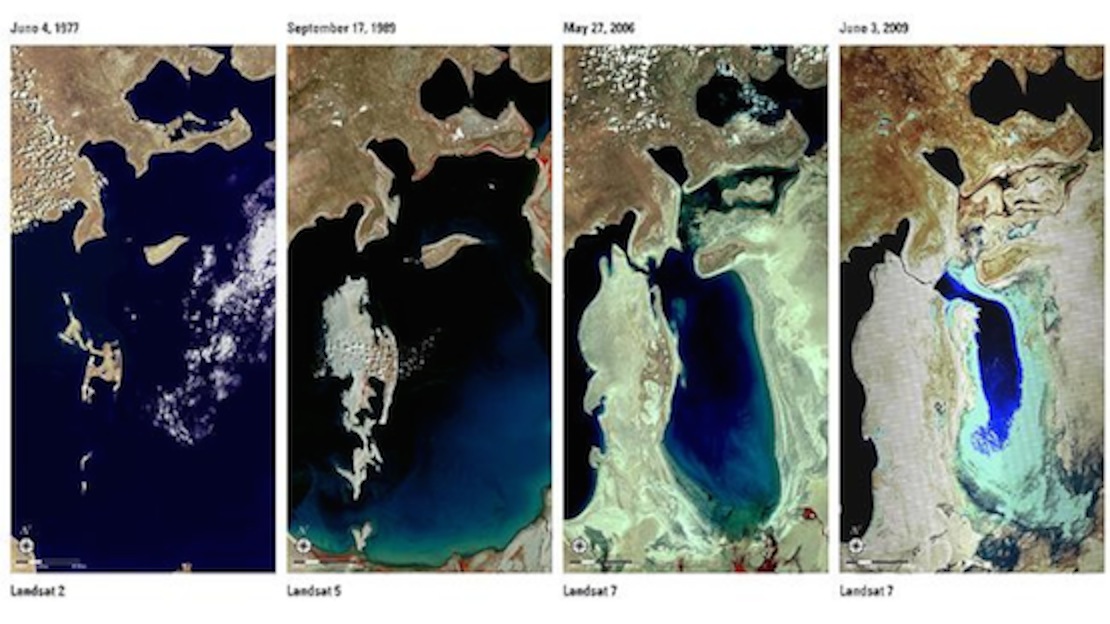
The Aral Sea, once the fourth largest lake in the world has shrunk to only 10 percent of its original size. The United Nations called the dying of the Aral Sea one of the planet’s most shocking disasters. Landsat 5 provided images to illustrate the changes. Similar striking images of Lake Chad, once the sixth largest lake in the world, show it shrinking to a twentieth of its former size as persistent drought continues to plague the area.
The satellite has also provided the United States Geological Survey (USGS) with dramatic images of the growth of cities. Comparison images of the Dallas-Fort Worth area clearly illustrate the urbanization of our planet.
Landsat 5 also provided extremely valuable images of events on our planet as they unfolded: The eruption of Mount Saint Helens, melting of ice in Antarctica, the Kuwaiti oil fires, the Chernobyl disaster, rainforest depletion, major wildfires and floods, urban growth, global crop production, ice shelf expansion and retreat – all have been dramatically photographed by the satellite and the photos have been published so that we all could see our planet from a perspective that we could not otherwise achieve.
The Landsat project began in 1972 with the launch of Landsat 1. Over the years, additional satellites have been launched. The mission will continue with the planned launch of Landsat 8 set for February of this year. In 2008, the entire Landsat archive became available for download at no charge. Since that date over 9 million images have been downloaded by scientists, businesses, students and the general public. I have been a frequent visitor to the USGS site: landsat.usgs.gov. Among the biggest users of Landsat images are fire officials with nearly 17% of downloads being made by fire agencies. Add to that the 19.5% of images downloaded by forestry officials and it is clear that Landsat images have become essential to the management of public lands. The original goal of the mission – to provide images for the study of geology – not amounts to only 3.6% of the use of the images. Clearly we have found many other ways to use the valuable data provided by these satellites.
This system of satellites that are continually transmitting images back to earth requires a complex system of ground support. The main center for receiving and processing the data from the satellites is located in our home state. The Landsat Ground Station (LGS) is located at the USGS Earth Resources Observation and Science (EROS) Center in Sioux Falls. A second site, halfway around the world at the Geoscience Australia facility in Alice Springs, Australia also receives the science date via X-band Radio Frequency and spacecraft housekeeping data on the S-band RF link. Additional ground receiving stations in Alaska and Norway are used as backup sites when additional ground resources are needed.
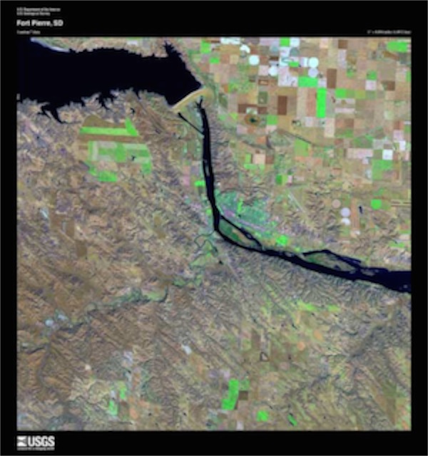
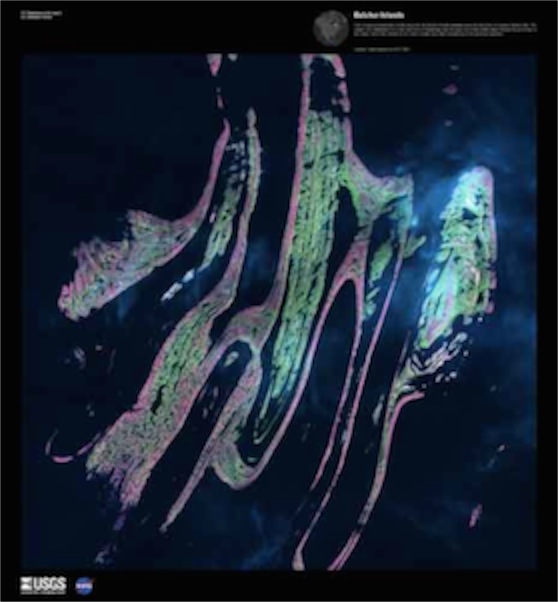 Over the years the USGS has provided several dramatic collections of images, including three “Earth as Art” collections of some of the most gorgeous images provided by the satellites. There are also mosaic images of individual states and a beautiful set of images of the journey of Lewis and Clark.
The Lewis and Clark “Corps of Discovery” was the beginning of what has now become the United States Geological Survey (USGS). The Corps of Discovery was a specially-established unit of the United States Army that formed the nucleus of the Lewis and Clark expedition between May 1804 and September 1806. The project was commissioned by President Thomas Jefferson in 1803. Jefferson’s personal secretary, Meriwether Lewis was named as leader and Lewis selected William Clark as his partner. They were given the job of undertaking an overland expedition to the Pacific Northwest in search of a route for travel throughout the Louisiana Purchase. Along the way they were to study the area’s plants, animal life and geography. The venture definitely had a commercial side as well. Learning how this vast area of land could be exploited economically was also an objective of the mission.
 South Dakota figured large in that original journey. The only death of a member of the Corps occurred near the edge South Dakota. Sergeant Charles Floyd died of what is believed to have been a ruptured appendix on August 20, 1804 near the site of the modern city of Sioux City. It was in what is now South Dakota that the Corps encountered the Dakota (Sioux) people for the first time. Now, over two centuries later, South Dakota continues to be an important part of the continuing exploration of the geology and geography of our nation and of the world through the activities of the EROS data center.
Our world continues to fascinate us. It continues to be worthy of extraordinary efforts to study and understand how it is changing over time. The Landsat project has provided a great deal of data. Interpreting that data and discovering its meaning is a critical to our time as was the interpreting of the information brought back by Lewis and Clark so long ago.
But today, in contrast with that long-ago journey, we get to watch the images of the explorers without having to wait years for them to return with the information. May we continue to learn from the information we are receiving and use what we have learned to be better stewards of this planet that is our home.
Now it its 29th year of orbiting our planet, it has made 150,000 circuits around our world and transmitted over 2.5 million images of the surface of the earth. It has given us a nearly three-decade view of how our world is changing.
The Aral Sea, once the fourth largest lake in the world has shrunk to only 10 percent of its original size. The United Nations called the dying of the Aral Sea one of the planet’s most shocking disasters. Landsat 5 provided images to illustrate the changes. Similar striking images of Lake Chad, once the sixth largest lake in the world, show it shrinking to a twentieth of its former size as persistent drought continues to plague the area.
The satellite has also provided the United States Geological Survey (USGS) with dramatic images of the growth of cities. Comparison images of the Dallas-Fort Worth area clearly illustrate the urbanization of our planet.
Landsat 5 also provided extremely valuable images of events on our planet as they unfolded: The eruption of Mount Saint Helens, melting of ice in Antarctica, the Kuwaiti oil fires, the Chernobyl disaster, rainforest depletion, major wildfires and floods, urban growth, global crop production, ice shelf expansion and retreat – all have been dramatically photographed by the satellite and the photos have been published so that we all could see our planet from a perspective that we could not otherwise achieve.
The Landsat project began in 1972 with the launch of Landsat 1. Over the years, additional satellites have been launched. The mission will continue with the planned launch of Landsat 8 set for February of this year. In 2008, the entire Landsat archive became available for download at no charge. Since that date over 9 million images have been downloaded by scientists, businesses, students and the general public. I have been a frequent visitor to the USGS site: landsat.usgs.gov. Among the biggest users of Landsat images are fire officials with nearly 17% of downloads being made by fire agencies. Add to that the 19.5% of images downloaded by forestry officials and it is clear that Landsat images have become essential to the management of public lands. The original goal of the mission – to provide images for the study of geology – not amounts to only 3.6% of the use of the images. Clearly we have found many other ways to use the valuable data provided by these satellites.
This system of satellites that are continually transmitting images back to earth requires a complex system of ground support. The main center for receiving and processing the data from the satellites is located in our home state. The Landsat Ground Station (LGS) is located at the USGS Earth Resources Observation and Science (EROS) Center in Sioux Falls. A second site, halfway around the world at the Geoscience Australia facility in Alice Springs, Australia also receives the science date via X-band Radio Frequency and spacecraft housekeeping data on the S-band RF link. Additional ground receiving stations in Alaska and Norway are used as backup sites when additional ground resources are needed.
The Lewis and Clark “Corps of Discovery” was the beginning of what has now become the United States Geological Survey (USGS). The Corps of Discovery was a specially-established unit of the United States Army that formed the nucleus of the Lewis and Clark expedition between May 1804 and September 1806. The project was commissioned by President Thomas Jefferson in 1803. Jefferson’s personal secretary, Meriwether Lewis was named as leader and Lewis selected William Clark as his partner. They were given the job of undertaking an overland expedition to the Pacific Northwest in search of a route for travel throughout the Louisiana Purchase. Along the way they were to study the area’s plants, animal life and geography. The venture definitely had a commercial side as well. Learning how this vast area of land could be exploited economically was also an objective of the mission.
Our world continues to fascinate us. It continues to be worthy of extraordinary efforts to study and understand how it is changing over time. The Landsat project has provided a great deal of data. Interpreting that data and discovering its meaning is a critical to our time as was the interpreting of the information brought back by Lewis and Clark so long ago.
But today, in contrast with that long-ago journey, we get to watch the images of the explorers without having to wait years for them to return with the information. May we continue to learn from the information we are receiving and use what we have learned to be better stewards of this planet that is our home.